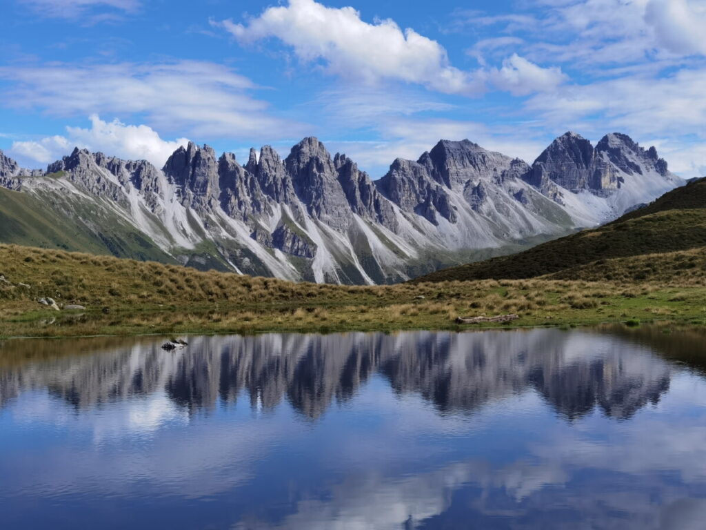
Salfeiner See – Mirror Lake of the Kalkkögel
Lake Salfeins, nestled at nearly 2,000 meters above sea level in the Stubai Alps, is a true gem. Despite its small size, it boasts a unique feature: in calm weather, the Kalkkögel mountain range is perfectly reflected in its surface, creating unforgettable photo opportunities. The moderately challenging hike to the lake makes it a popular destination for families and nature lovers. The landscape surrounding the lake is characterized by alpine meadows and breathtaking panoramic views.
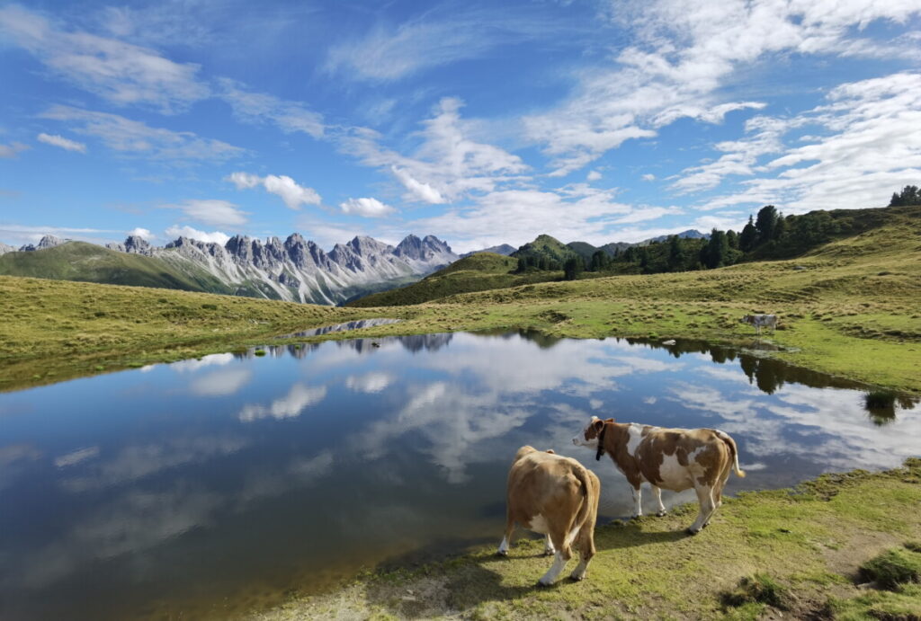
Lake Salfein near Innsbruck is known as the mirror lake of the Kalkkögel mountains . To be precise, it’s called Lake Salfeins , or Salfeinssee . Its name comes from the summit of Salfeins, which rises about 20 meters directly above the lake. I mistakenly assumed it was called Salfeinsee , but that’s wrong—it’s missing an “s.” Older people know the lake as Schönangerlsee or Schönangersee. Schönanger is the name of the mountain saddle on the Salfeins, which is why it’s marked with this name on some maps. And yes, it is a picturesque mountain lake in Tyrol. Although it’s less of a lake and more of a shallow lake—a smaller, more intimate version of a lake. The pictures with the silhouette of the Kalkkögel mountains give the impression of a large lake, but that’s not the case. Depending on the water level, the shoreline measures only about 200 to 250 meters. That’s very short. You can walk around the entire lake in two minutes.
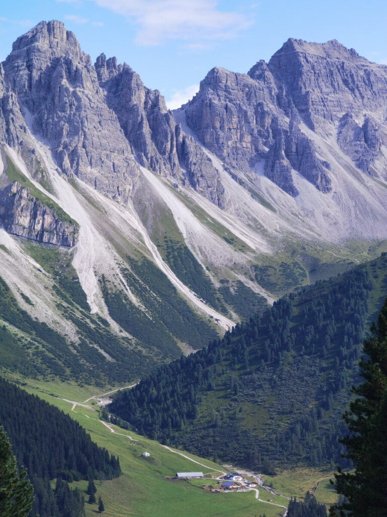
It lies near the imposing Kalkkögel mountain range , which rises majestically in the background. The lake is approximately 5 kilometers (5 miles) as the crow flies from these striking mountains, which resemble the Dolomites. The lake owes its name to its characteristic ability to reflect the surrounding Kalkkögel mountain panorama in its mirror-like surface. Lake Salfeiner reflects the sublime beauty of the Kalkkögel mountain range, which belongs to the Stubai Alps. This impressive mountain range includes peaks such as the Schlicker Seespitze, which, at 2,804 meters (1,100 feet) above sea level, marks the highest point of the Kalkkögel.
Where is Lake Salfein located?
Lake Salfein lies above the village of Grinzens (Tyrol), near Innsbruck. More precisely, it is situated in the vicinity of the impressive Kalkkögel mountain range (Stubai Alps). It lies below the Salfein summit at an altitude of 1985 meters. Here is the link to the Google Map .
Can you drive by car to Lake Salfein?
No, it’s not possible to drive to Lake Salfein. The road into the Senderstal valley, where Lake Salfeins is located, is a toll road that can only be driven up to a certain point. The rest of the way from that point to the alpine pasture and the lake must be hiked.
How big is Lake Salfeins?
Lake Salfeins is relatively small. Depending on the water level, the shoreline of the lake extends for about 200 to 250 meters.
Salfeiner See Hike – 3 paths lead up
I’ve often seen pictures of this special mountain lake. Today I have time to take a closer look at Lake Salfeiner. Three hiking trails lead up to it: The direct route starts in Grinzens at the entrance to the Sellrain Valley. From here, the trail climbs about 1,000 meters to the summit. The other two trails have a shorter ascent. They start in the Senderstal Valley. You can drive further up there on a toll road and hike with less elevation gain. One of the Salfeiner See trails starts at the first parking lot in the Senderstal Valley, from where it’s about 500 meters to the lake and the summit. The other Salfeiner See trail begins at the end of the toll road near the Kemater Alm. The direct hike from here involves about 350 meters of elevation gain.
- Direct route from Grinzens:
- Starting point: Grinzens, entrance to the Sellrain valley
- Ascent via a hiking trail
- Total elevation difference: Approximately 1000 meters
- Difficulty level: Medium due to the longer ascent
- Variant from Senderstal (first parking lot):
- Starting point: First parking lot in Senderstal
- Ascent via forest road & hiking trail
- Total elevation difference: Approximately 500 meters
- Difficulty level: Moderate, shorter ascent
- Variant from Kemater Alm (end of the toll road):
- Starting point: Kemater Alm, end of the toll road
- Direct hike with minimal elevation gain
- Total elevation difference: Approximately 350 meters
- Difficulty level: Easy to moderate, short climb
The Salfeiner See hike via Salfeiner Alm
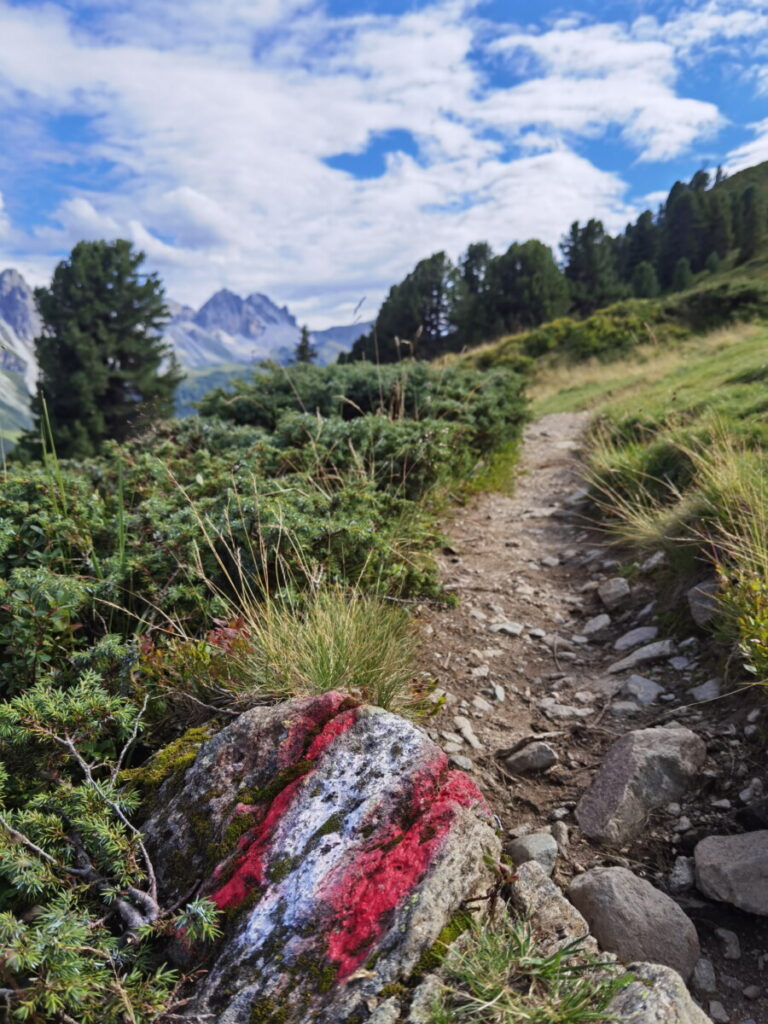
I opted for the moderately difficult hike – starting from the Kalch parking lot . This is the first parking lot in the Senderstal valley . You can reach it via the toll road to the Kemater Alm . It begins in Grinzens at the entrance to the Senderstal valley. It’s about 4 kilometers from Grinzens to the parking lot. You can officially park your car there. Here’s the link to the Google map . The parking lot is open during the day from 8 a.m. to 10 p.m. Overnight parking and camping are prohibited. Camping seems to be a problem here in general. Apparently, some incorrigible “nature lovers” have pitched their tents at Lake Salfeins several times. That’s why there’s a sign on the trail indicating the camping ban on the mountain. At the parking lot, I found signs for Salfeins and the Salfeinser Alm. The lake itself isn’t signposted. Don’t let that confuse you; this is the right path. It leads across the alpine pasture up to the summit of Salfeins, where the lake is located.
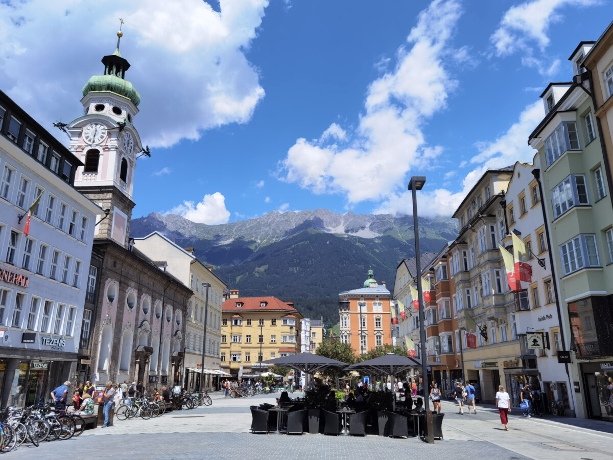
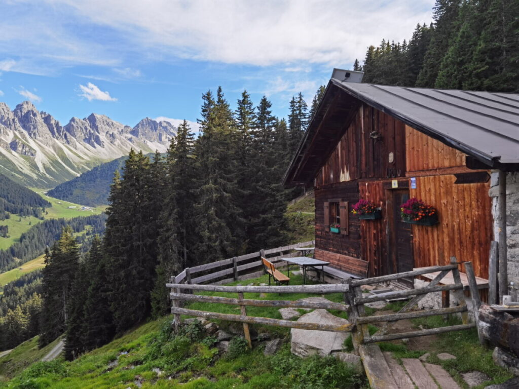
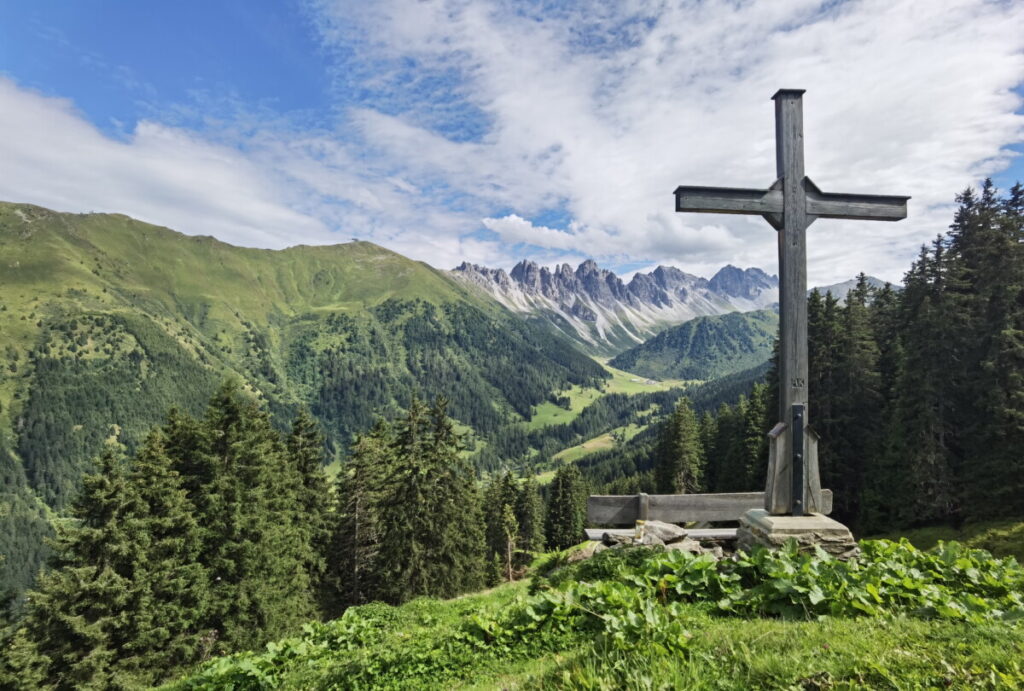
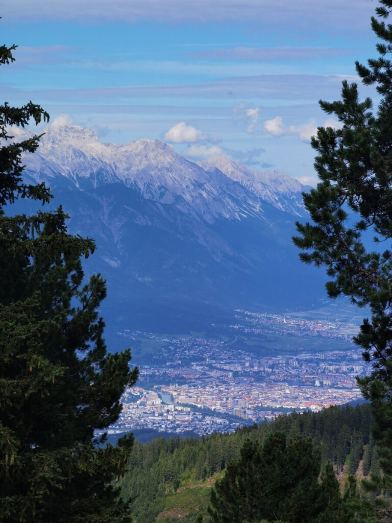
I follow the signs. The first part of the Salfeiner See hike is uneventful, leading through the forest on a forest road (closed to mountain bikers). After a hairpin bend, the hiking trail branches off. It leads directly up to the Salfeiner Alm. Here I get my first view. In front of the Alm, there’s a bench with a cross. The Kalkkögel mountains are fully visible, as is the Kemater Alm. The bench is an invitingly beautiful spot for a break. However, I don’t linger too long and continue hiking. Beyond the Alm, the trail leads through a light mountain forest. It winds past berry bushes up to the next viewpoint. This one faces the Inn Valley. From here, I can see the old town of Innsbruck , which is about 13 kilometers away as the crow flies.
A few Swiss stone pines still stand up here, but the forest is thinning. The trail leads up to the summit. There’s another water source along the way to refill my water bottle. Then comes the final ascent, and I reach Lake Salfeiner. It’s a small lake that would be completely unremarkable if it weren’t for the panorama of the mirror-like Kalkkögel mountains. I walk the last few meters to the summit. There I encounter horses and cows enjoying a scenic summer on the alpine pastures. The view stretches into the Sellrain Valley, the Upper and Lower Inn Valleys – including Innsbruck. Opposite, I can see the Wetterstein Mountains and the Zugspitze. I can even see Seefeld.
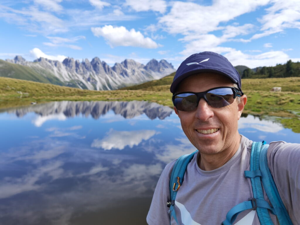
Before hiking back down, I take the famous picture of Lake Salfeins. The best time for good photos is late afternoon until sunset. Then the sun is positioned to illuminate the limestone cliffs beautifully. My return route follows the same path I took up. If you like, you could do a circular hike and walk along the ridge to the Kemater Alm. This route takes you over the Grieskogel.
The data for the Salfeiner See hike
My hike to Salfeinssee took me about 1.5 hours to get to the top. The return trip took less than an hour. The elevation gain and loss was approximately 500 meters. The total distance was about 6 kilometers.
- Ascent time: approx. 1.5 hours
- Descent duration: less than 1 hour
- Total elevation gain and loss: approx. 500 meters
- Total length of the hike: approximately 6 kilometers
- Hike to Lake Salfeiner: suitable for families, short and easy
- Scenic highlights: Reflection of the Kalkkögel mountains in the lake, picturesque backdrop
- Starting point: Parking lot P1 Kalch im Senderstal
- Sights: Kalkkögel, idyllic Salfainssee
- Low difficulty: also suitable for less experienced hikers
- Nature experience: Alpine rose meadow, Swiss stone pine forest, beautiful views
- Suitable for: Family outings, nature and hiking lovers
- Tip: Visit in the late afternoon for the best lighting and photos.
Interesting Facts About the Kalkkögel Mountains:
The Kalkkögel, often called the “North Tyrolean Dolomites,” are known for their distinctive shape and dolomite rock formations. The mountain range consists of Mesozoic sediments, including dolomite from the Middle and Upper Triassic periods. The Kalkkögel and their surroundings are not only geologically remarkable but also a popular destination for hikers, climbers, and skiers. The Kalkkögel offer a variety of peaks that adventurers can conquer, including the Schlicker Seespitze, Ampferstein, and many others.
Personal conclusion
My personal conclusion about Lake Salfeiner? First of all, let’s be honest: if you’re looking for the vastness and size of bodies of water like Lake Achensee or Lake Walchensee , this is definitely not the place for you. Lake Salfeiner is more of a modest, small lake, and you don’t need to make the trip just for the water. What makes the lake so special, however, and the hike absolutely worthwhile, is its unique characteristic as a mirror lake . When there’s no wind, it transforms into a perfect mirror surface for the Kalkkögel mountains . It’s a truly breathtaking sight. Furthermore, the hike itself is simply stunning. The trail offers fantastic views at every turn and is a delight in itself.
Frequently Asked Questions
No. Lake Salfeins isn’t deep enough. If you’re looking for a beautiful mountain lake or swimming lake near Innsbruck, I have a list of the most beautiful lakes around Innsbruck.
The walking time is approximately 2.5 hours (round trip), depending on your pace. Allow enough time extra for breaks and to enjoy the views.
Yes, you can do this hike with children. It’s not technically challenging and not too long. The destination is exciting for children, and the route itself is interesting.
Further links
- the 7 most beautiful mountains in Innsbruck
- You can also go hiking here in Innsbruck.
- The Ehnbach Gorge is not far from here.
- another great fotospot lake, the Lago di Sorapis